TimTaiLieu.vn - Tài liệu, ebook, giáo trình, đồ án, luận văn
TimTaiLieu.vn - Thư viện tài liệu, ebook, đồ án, luận văn, tiểu luận, giáo trình các lĩnh vực CNTT, Ngoại ngữ, Luật, Kinh doanh, Tài chính, Khoa học...

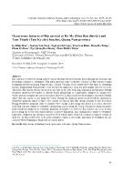 Occurrence features of Rip current at Ha My (Dien Ban district) and Tam Thanh (Tam Ky city) beaches, Quang Nam province
Abstract Rip current is a relatively strong, narrow current flowing outward from the beach through the surf zone and presenting a hazard to swimmers. This paper presents some occurrence features of Rip current at main swimming beaches in Quang Nam province, Central Vietnam. Study results show that most of swimming beaches along Quang Nam provin...
 11 trang | Chia sẻ: thanhle95 | Ngày: 06/07/2021 | Lượt xem: 704 | Lượt tải: 0
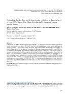 Evaluating the shoreline and bottom terrain variations in the naval port of zone 5, Phu Quoc, Kien Giang by using multi - Temporal remote sensing images
Abstract In this study, the authors aim to study two major contents: (1) Evaluating the shoreline variation in the naval port of zone 5 (in the years of 1999, 2006, 2009 and 2016); (2) Evaluating the bottom terrain variation in the naval port of zone 5 (in the years of 2007 and 2010). Three main research methodologies were applied: (i) Band rat...
10 trang | Chia sẻ: thanhle95 | Ngày: 06/07/2021 | Lượt xem: 794 | Lượt tải: 0 Study on spatial distribution of coral reefs in Nam Yet island by using GIS and remote sensing techniques
Abstract Research and application of GIS and remote sensing techniques combined with field survey in coastal areas of Nam Yet island had been carried out to establish the distribution map of submarine habitats. Depthinvariant index was used to correct water column’s effects on spectral reflectance of each habitat. The results of satellite image ...
11 trang | Chia sẻ: thanhle95 | Ngày: 06/07/2021 | Lượt xem: 968 | Lượt tải: 0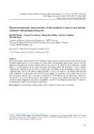 Recent geodynamic characteristics of the Southern Central coast and the relations with geological hazards
Abstract Recent geodynamic characteristics of the Southern Central coast are analyzed on the basis of vertical and horizontal displacement velocities along active fault zones. The horizontal displacement velocity varies in magnitude from this fault system to another fault system, from 0.11–0.3 mm/year on the strike-slip - normal faults to 0–0.0...
12 trang | Chia sẻ: thanhle95 | Ngày: 05/07/2021 | Lượt xem: 834 | Lượt tải: 1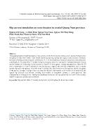 Rip current simulation on some beaches in coastal Quang Nam province
Abstract This paper presents modelling results of rip currents on the main beaches along coastal Quang Nam province including Ha My, Binh Minh, Tam Thanh and Rang beaches during two typical wind seasons: Northeast monsoon (Northeast wind direction, wind levels: 4, 5, 6) and Southwest monsoon (Southeast wind direction, wind levels: 4, 5) using M...
12 trang | Chia sẻ: thanhle95 | Ngày: 05/07/2021 | Lượt xem: 767 | Lượt tải: 0 Research on effects of geo-hydrodynamics on topographic changes in the estuary of Cua Dai, Quang Nam province
Abstract Accretion and erosion processes recorded in the estuary of Cua Dai, Quang Nam province from 2014 to present have directly affected the issues of flooding drainage system, waterway traffic, aquaculture and seafood exploitation services. These have been drawing special attentions of national and international scientists. So far, several ...
8 trang | Chia sẻ: thanhle95 | Ngày: 05/07/2021 | Lượt xem: 821 | Lượt tải: 0 Establishing calculation method for chemical composition of primitive magma in the Cenozoic in South Central coast region and the adjacent continental shelf of Vietnam
Abstract The calculations which determine the chemical composition of the primitive magma are simple but they show changes in the temperature and pressure states of the magma source. The method is based on the addition of the chemical composition of the Olivine to the major element composition of the eruptive rocks which follows the formula: Ci...
16 trang | Chia sẻ: thanhle95 | Ngày: 05/07/2021 | Lượt xem: 915 | Lượt tải: 0 Vietnam geographical exploitation under the United Nations Convention on the Law of the Sea in 1982 (UNCLOS 1982)
Abstract As an active member of the United Nations Convention on the Law of the Sea - UNCLOS, Vietnam has completed 3 Reports on the Limits of the Continental Shelf and has submitted two of them to the Commission on the Limits of the Continental Shelf - CLCS, before the deadline 13-5-2009. Those are: (1) Outer Limits of the Vietnam’s Extended C...
12 trang | Chia sẻ: thanhle95 | Ngày: 05/07/2021 | Lượt xem: 818 | Lượt tải: 0 Building database of WEBGIS for the exchange of marine data between Vietnam and ASEAN countries
Abstract The system of oceanic database management and exchange is built with the purpose of exchanging the oceanic data between Vietnam and other ASEAN countries. The system can meet the demand of sharing and exchanging oceanic data through internet connection between Vietnam and ASEAN member countries. Besides, the system of oceanic database ...
13 trang | Chia sẻ: thanhle95 | Ngày: 05/07/2021 | Lượt xem: 823 | Lượt tải: 0 Institute of Marine Geology and Geophysics - 30 years for studying geology and geophysics in the marine zones of Vietnam and Eastern Sea
Abstract Geological and geophysical investigation and study in the marine zones of Vietnam and Eastern Sea, its application in the mineral exploration, for natural disaster and hazard prevention, environment and resource protection, for sea and island management, marine economic development, sea defence and security is the important, main and l...
15 trang | Chia sẻ: thanhle95 | Ngày: 05/07/2021 | Lượt xem: 718 | Lượt tải: 0

